Buckeye – Arrow
Back to Projects Page
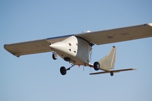
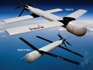
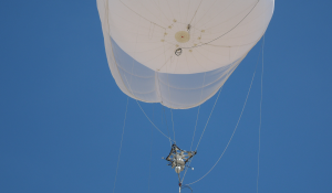
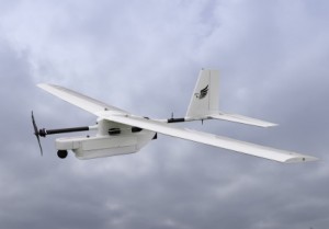
Arrow
State of the art tactical level unmanned aerial system capable of supporting operational missions such as border and port patrol, special operations, homeland defence and security, urban mapping, counter narcotics application and disaster preparedness.
Total area coverage for ISR missions from 2010 to present is 70,000 sq km. Typical mission collection is 50-80 sq km. Typical mission time from start of checklist to post flight inspection is 6-7 hours.
Primary mission for mapping and 3D modeling of Jordan and SW Afghanistan including Heart Province, Shindand, Farah and the Zirkoh Valley. Data collected was also used for monitoring changes and growth along the two main highways in the SW region Hwy 1 and Hwy 515.
Data is used to support ODA and MARSOF teams throughout the region for mission preplanning. The detailed EO imagery allows troops to properly identify targets of interest in order to prevent collateral damage. Teams are provided data drops monthly to ensure they have the most current and accurate data available.
Overview
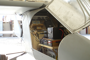
NEANY’s flagship UAS, the Arrow, is suitable for both military and commercial applications where dependability and extended endurance are required. The Arrow is an efficient, cost effective solution for battlefield and homeland security operation areas and is equipped with a 6 megabit TCP/IP data-link for disseminating valuable real-time intelligence, video, and situational awareness data. The Arrow features a large payload area of fifteen cubic feet and can accommodate sensor packages weighing up to two-hundred and fifty pounds. The UAV is a converted light-weight manned airplane that is built using over ninety-percent commercially available parts, making it a low-cost and easily sustained operational asset.
Capabilities
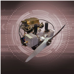
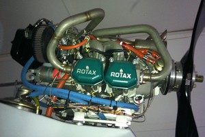
The aircraft combines friendly low speed handling characteristics with agility and high performance. It has been designed to a +6g / -4g load limit capability at over 1000 pounds gross weight. The current configuration uses a Rotax-912ULS engine capable of achieving altitudes of 10,000 feet AGL and cruising speeds of 80MPH. At cruising speed and over 1200 pounds gross vehicle weight, the vehicle consumes fuel at a rate slightly above 4GPH.
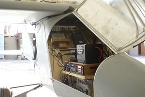
The Arrow UAV is equipped with an automatic takeoff and landing (ATOL) system, making it capable of fully autonomous flight. A specially designed alternator provides 100A of power at 28VDC while idle, combined with 12VDC and 24VDC power supplies each capable supplying up to 800W of power, can support even the most power hungry payload. A broadband UHF data-link with the ability to achieve full-duplex 6 megabit data rates at ranges exceeding sixty miles is also available.
Specifications
- Payload capacity, full fuel: > 200 pounds | > 91 kilograms
- Payload area volume: 15 cubic feet | 0.42 cubic meters
- Fuel capacity: 53 gallons | 201 Liters
- Empty weight: 900 pounds | 408 kilograms
- MTOW: 1350 pounds | 612 kilograms
- Altitude Above Ground Level: 12,000 feet | 3657.6 meters
- Endurance: 12 hours
- Fuel burn rate: 3.9 gallons/hour | 15 Liters/hour
- Range: 50 NM Line Of Sight | 92.6 kilometers
- Cruise speed: 60 knot | 111 kilometers/hour
- Stall speed: 35 knot | 64 kilometers/hour
- Climb rate: 1600 feet/minute | 487 meters/minute
- Take off/landing: Automatic
- Length: 19 feet | 5.8 meters
- Wingspan: 23 feet | 7 meters
- Height: 6 feet 6 inches | 19.8 meters
- Engine: Rotax 912; 100 horsepower
- Payload power: 800 Watts @ 24 Volts Direct Current & 800 Watts @ 12 Volts Direct Current
- Fuel: Aviation gas
Applications include : ISR, Mapping, C-IED, Precision agriculture, Weapons deployment
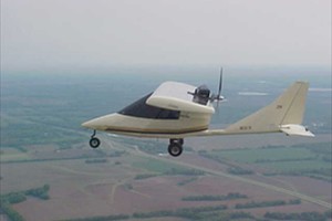
Buckeye
NEANY’s customer is the Army Corps of Engineers, Army Geospatial Center (AGC). NEANY began converting the Titan Aircraft Tornado II kit plane to a UAS in 2003. NEANY was awarded a prime contract in 2007 to integrate and flight test the 235 pound BuckEye LIDAR system on the Arrow. The BuckEye received the 2006 Army Invention of the Year Award.
Supporting CONOPS for Change Detection, Intelligence, Surveillance and Reconnaissance (ISR), and Urban Mapping.
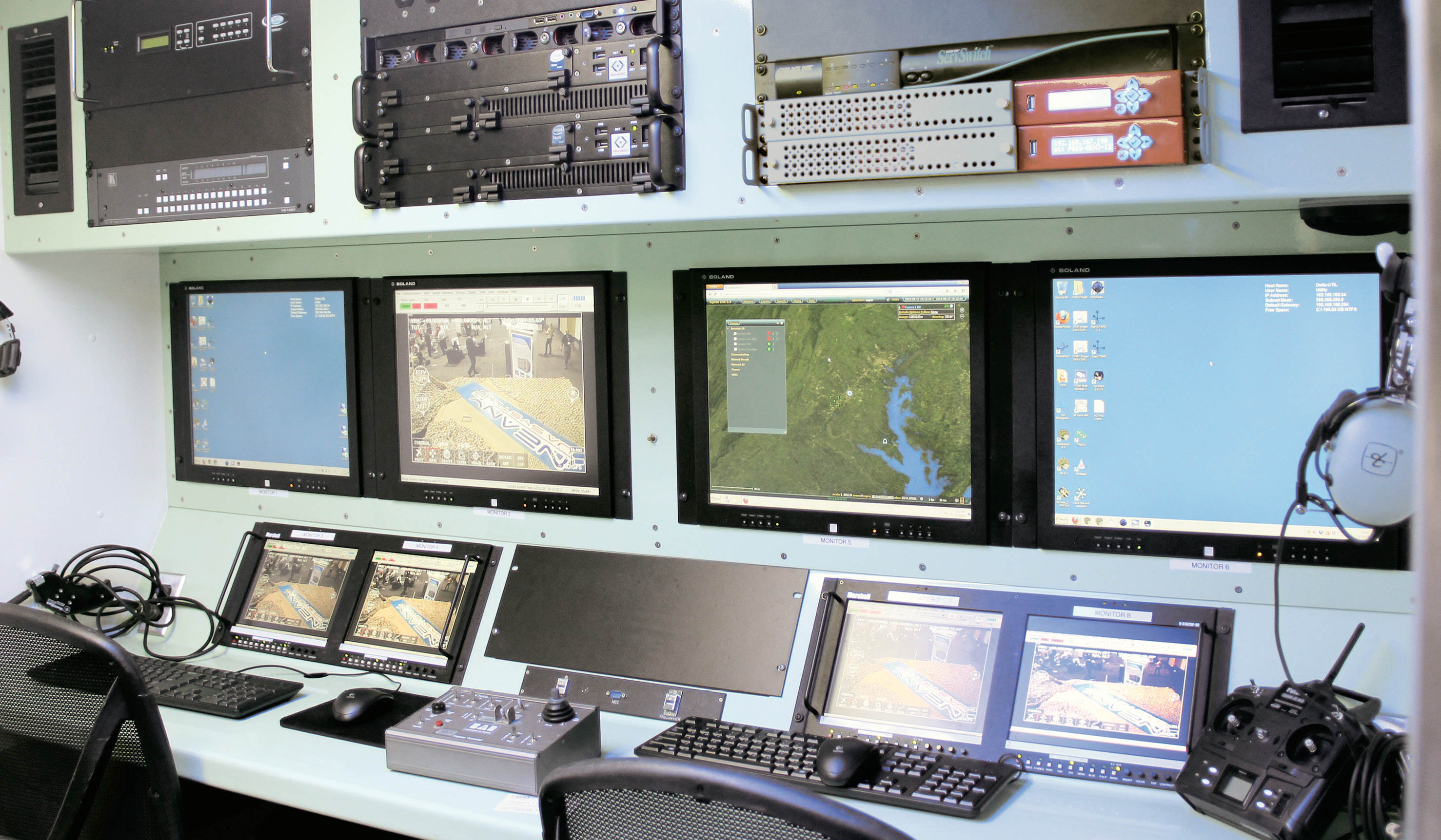
System Footprint :
- Two air vehicles
- 12’ ground control shelter
- BAI MCC
- AGIG
- Four Operators
Milestones :
- Installed and certified air vehicle for automatic takeoff and landing (ATOL) April 2010.
- Initial deployment July 2010
- Created hub and spoke infrastructure October 2011
- Extended range to 120 miles
Statistics :
- Months in theater >50
- Number of operational flight hours : over 3000 hours
- Average fuel burn : 4.5 gal/hour
- Scheduled maintenance : 135 hours
- Cost per flight hour : $1,904.00
Back to Projects Page